


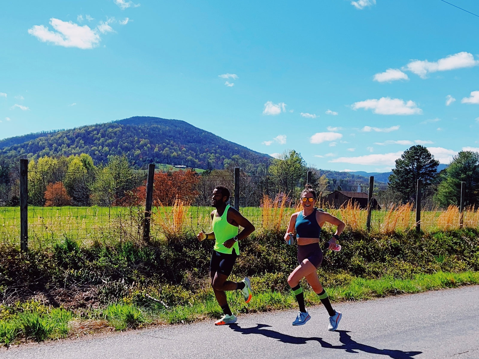

Charlottesville is home to many good running spots—I could probably write a small novella length post on the great routes and roads to try just outside of town. In particular, if you know where to look, you can find some truly excellent long run spots either right in town or just a 10-15 min. drive away.
Here are 6 of those spots: 4 are just outside of town and worth the small drive to find uniquely Virginia scenery, excellent gravel conditions, and can easily support a run from 7 to 15+ miles. The last 2 locations described here are in town and require more minimal or no driving, and are somewhat opposites in terms of surfaces and setting! In Charlottesville, you will never find yourself short of variety of running locales for a long run (even if you tend to stick to the same old loop for your weekday runs as I do)!
I myself am directionally challenged (cue the flashback to one of my running buddies commenting on my Strava on my map where I was obviously trying 3 different roads until I found the right one of a route that we had run many times together: “you finally got it!!”). And thus, in the spirit of keeping you on track, I am including what I hope are very easy, friendly-to-follow directions here plus some great places to check out nearby after your run for coffee or postrun snacks!
Require a 10-15 min. drive:
1. Dick Woods Road:

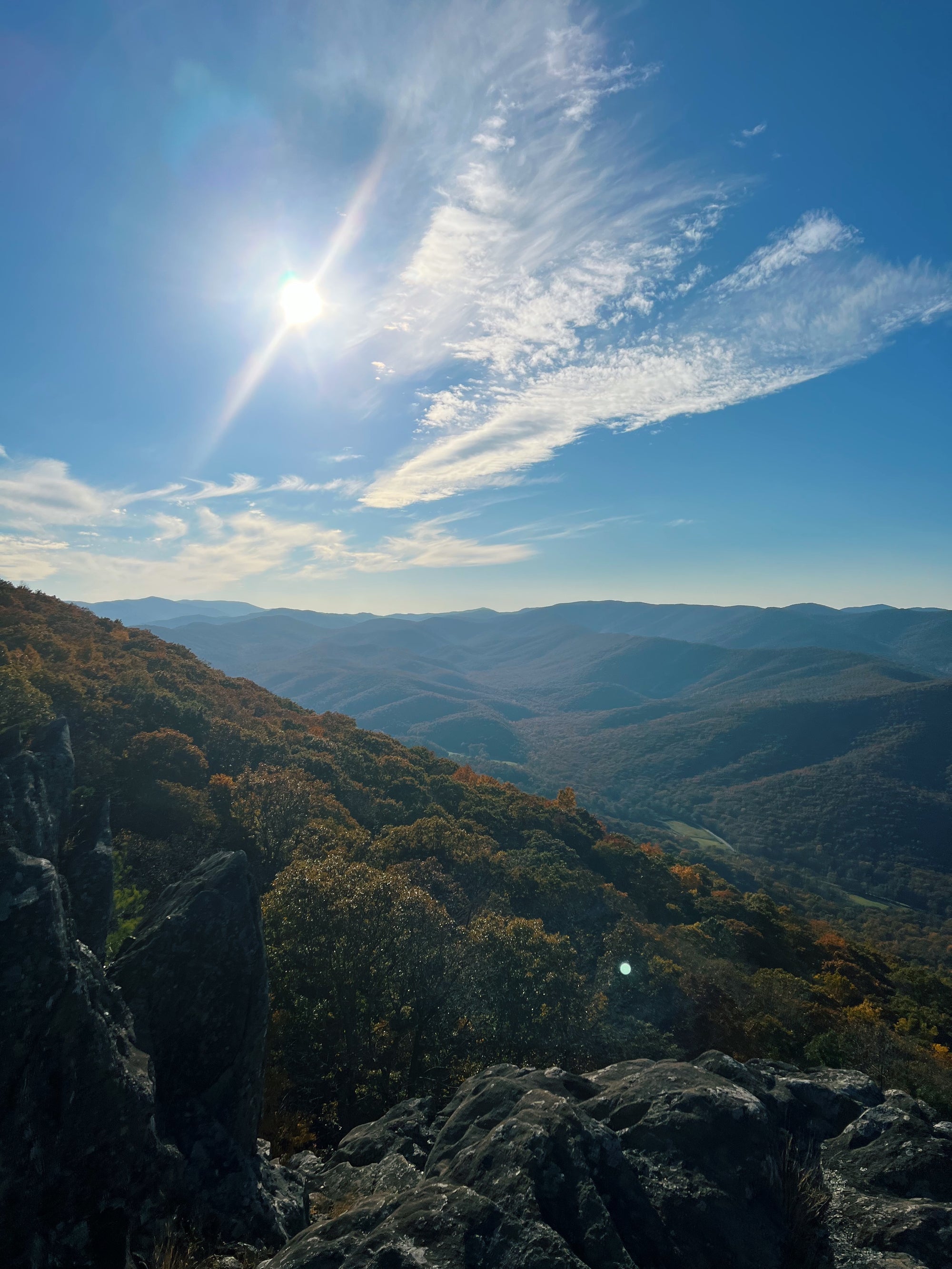
Dick Woods Road is a classic Charlottesville long run spot featuring gravel roads with a range of scenery, from winding forested miles to open pastures.
Where to park: the small parking lot between the intersection of Miller School Road and Dick Woods Road. Important note here: Dick Woods Road actually intersects with Miller School Road in two locations (and if you type the intersection directly into GoogleMaps right now, it will take you to the wrong one). If you use this address, which is at the very base of Dick Woods Road, note you will be looking for the obvious gravel parking lot right near here.
Driving directions linked here
Bathroom situation: the woods. (Hint: this will become a theme.)
Maximum length of run: just over 15 miles as an out and back (you can go further out, but I am not sure I’d recommend that as it is a massive, unfriendly, steep hill at the traditional turnaround)—anytime I’ve run further than 15 miles here, I instead just do progressively shorter out-and-backs from the top of the initial hill.
Basic directions: (Dick Woods for 3.6 mi., RT on Ortman for 0.5, continue on Dick Woods for another 4.1 miles until you hit Critzer Shop Road at approx. 7.8 mi., the turnaround spot)
- From the parking lot, turn right to go up the hill and continue on Dick Woods Road.
- In just about 2 miles, you will cross Plank Road. Continue straight to stay on Dick Woods Road. This next stretch right after this has lots of really neat foliage, trees, little bumpy hills and windy bends. It is fun.
- After 3.6 miles total run, you will come to an intersection with Ortman Road. Go right here.
- After 0.5 miles on Ortman, make a left to continue on Dick Woods Road (you've now run about 4.1 mi. total distance). Now you just stay on Dick Woods Road as long as you like until you want to turn around!
- If you are going the full length of Dick Woods Road, the traditional turn is at Critzer Shop Road (about 7.8 miles total for the way out).
What to expect: rolling hills!
Why it is fun:
- Net downhill on the way back in: You will possibly not notice this while running (which is actually a good thing), but there is slightly more downhill on the way coming back in than going out. The rolling hills tend to make this “uphill on the way out, downhill on the way back in” effect less obvious, but it will make you just that much extra peppy on the second half and who doesn’t want to finish a long run feeling good if possible!?
- Beautiful scenery and gravel! This run includes nice sections of trees, which provide shade or beautiful foliage depending upon the season.
Where to go after:
- Coffee: Mudhouse Coffee in Crozet is probably the most scenic of the Mudhouses; it has stained glass and a neat old-time feel to it! I recommend the mocha and chai tea latte, in addition to ALL of the baked goods.
- Food: Batesville Market is an easy hidden gem recommendation here! This excellent country store has unique snacks, freshly made sandwiches, and fun drinks from kombucha to unique pops and teas. Sit outside at a picnic table and enjoy the sunshine and breeze in a beautiful country setting!
2. Keene

While this 7 mi. lollipop route is now half paved, it still remains an excellent spot for a long run with more gently rolling hills (by Charlottesville standards) and scenic country views.
Where to park: in the parking lot to the right of the Christ Church
Driving directions linked here (900 Glendower Road, Scottsville, VA 24590)
Bathroom situation: the woods. Luckily the woods are plentiful!
Maximum length of run: as many 7 mile loops as you want to do!
What to expect: While this formerly entirely gravel loop now has pavement for a good portion of the route, it is very scenic, with a variety of landscapes to admire as you run, from open pastures to more closed in woods. It is medium hilly (less hilly than Dick Woods Road). It is, according to my friends who actually do speedwork unlike me, great for a long run workout now since the paved portion makes for a faster feel. (Note: Coles Rolling Road and Blenheim are paved, Glendower is still part gravel for your speed planning purposes.)
Basic directions: You can obviously do the loop either counterclockwise or clockwise. Here are directions for both to make your life as easy as possible! Note that this loop is actually technically a lollipop (i.e. a loop with a short segment attached to get to the actual loop).
- From the church parking lot, turn left. Run about 0.3 miles until you get to the intersection of Coles Rolling Road and Glendower Road. You are now at the start of the loop. Note this is a handy corner at which to drop fluids/nutrition off for subsequent loops! You can now choose your loop adventure by choosing your direction!
-
Counter-clockwise: Coles Rolling Road (3 mi.), then LT on Blenheim (2.2 mi.), then LT on Glendower (1.8 mi.)
- at the intersection above, turn right to go on Coles Rolling Road. Follow Coles Rolling Road for almost exactly 3 miles.
- Make a sharp lefthand turn onto Blenheim Road. This is a very sharp turn—you will be able to easily see where you have come from on Coles (or anybody you’ve dropped, wink wink) as you continue on Blenheim. Follow Blenheim for approximately 2.2 miles—along the way you will pass signs for the Mount Ida Event Barn as well as some dogs which will definitely run out and bark at you.
- Make a left onto Glendower—don’t miss this turn like I did back in 2018 when I ended up running an unexpected 22 mile long run! Follow Glendower for another 1.8 miles to get back to the start of the loop. The Glendower section has the remaining gravel of this route and a quick up and down hilly section. You will be rewarded as you come into the end with a “stop sign ahead” sign which signals you are really almost there!
-
Clockwise: Glendower (1.8 mi.), then RT onto Blenheim (2.2 mi.), then RT onto Coles Rolling Road (3 mi.)
- At the intersection above, continue straight to go on Glendower Road. This is a nice gravel section which begins fairly flat and will progress to some bumpy little hills for you. Follow Glendower for 1.8 miles.
- Make a right into Blenheim Road and follow Blenheim for 2.2 miles. As noted above, this section includes such scenery as the Mount Ida Event Barn signage (if you see this, you’re going the correct way!) as well as some barking canines (you are def going the right way).
- Make a sharp right onto Coles Rolling Road, which you will follow for 3 miles back to the start of the loop!
Why it is fun:
- Simplicity of planning. The 7 mile loop length makes this a great choice for a long run of—you guessed it—7, 14, or 21 miles, or any length just over that. You can easily stash fluids and nutrition at the start of the loop and replenish as you go!
- Easy to add on a spare mile or two on a new road at the end: If you need a little extra mileage over this 7-14-21 mile interval, you can easily add on another mile in an out-and-back by passing up the normal “finish” at the parking lot where you started and continuing straight for a nice out-and-back with lots of trees.
Where to go after:
- Did someone say baked goods? Make a detour to Baked on the James in Scottsville (except on Sunday or Monday, as they are closed!) for cupcakes (find the cupcake menu here).
- If you are coming from Charlottesville, 5th Street Station and everything in that vicinity is also a great stopping spot on your way back into town.
3. Free Union

Where to park: Free Union Country School (obviously park here during non-school hours)
Driving directions linked here(4220 Free Union Rd, Free Union, VA 22940)
Bathroom situation: the woods. Woods are plentiful for most of this run, even along the run, so you should be fine!
Maximum length of run: 8 miles roundtrip as described
What to expect: really nice gravel country roads, extremely scenic views, a nice mix of hilly and flat sections
Basic directions: (RT on Free Union for 0.15, LT to continue on Free Union for another 0.1, LT to turn onto Millington until you see Wesley Chapel Road in another 0.35 (about 0.6 mi. total run). Follow Wesley Chapel until 3 mi. run total, then RT onto Chapel Spring for 1 mi.
Note the beginning part is the most confusing sounding part here: once you are on Wesley Chapel Road, follow that until you get to Chapel Spring Lane (3 miles total run), which you then follow to the very end (4 miles total one way). You will spend most of your time of these two roads. Here is a potentially helpful Strava link to this run.
- From Free Union Country School, turn right to follow Free Union Road for approximately 0.16 miles (this is one of the busiest stretches of road so be careful and alert here; it will soon calm down).
- Then, turn left at the intersection of Buck Mountain and Free Union Road to stay on Free Union Road for another 0.1 miles.
- Keep left to turn onto Millington. After you've run about 0.6 miles total, you will then go right on Wesley Chapel Road.
- Continue to follow Wesley Chapel Road until you see Chapel Spring Lane at very close to the 3 mile mark of your run. Go right onto Chapel Spring Lane.
- Follow Chapel Spring Lane for about 1 mile until you get back to Free Union Road. There will be a neat little triangle that you can run around! Go back the same way you came!
Why it is fun:
- Really pretty scenery, typically excellent gravel road conditions! You will really feel like you are exploring the Virginia countryside here!
- Great place for longer tempos! Ali, my directionally blessed running friend who was consultant on this piece, once did 15 miles at marathon pace here. If you do a longer workout, I would recommend dropping any beverages after the turn onto Wesley Chapel so you don't have to repeat the busier opening portion too.
4. Sugar Hollow

Sugar Hollow is an ideal choice for practicing perceived effort, and offers peaceful riverside views for the majority of the run.
Where to park: White Hall Ruritan Club parking lot
Driving directions linked here (2904 Browns Gap Turnpike, Crozet, VA 22932)
Bathroom situation: a nice clean port-a-potty behind the Ruritan Club Building, hurray! (Side note: if you’d like to support the Ruritan Club, they hold a spring 5k/10k at Sugar Hollow too!)
Maximum length of run: This is a more open ended run in terms of length: the runnable stretch described here is approx. 4.7 miles out (and thus 9.4 for the whole way out and back) but is easily customizable as described below if you run the bottom section for several out-and-backs avoiding the big initial descent/ascent. This bottom section is about 3.5 miles one way, so you can easily work your way back and forth down there for a while before coming back up the hill.
What to expect: a flat section of 0.6 at the top, followed by a bigger descent of about a half mile to get to the flatter section at the bottom. However, don’t be fooled! The flat section at the bottom is actually very sneakily slightly uphill for pretty much the entire way going out!! (The first time I ran here was at the end of my very first lifetime 70 mile week during the spring of 2020, and while running the “flat section” I could not stop thinking “wow, so this is what 70 miles on your legs feels like!”—I felt, uh, not peppy—but then I turned around and suddenly felt like a magical superhero while running and figured it out!) My speedwork friends tell me that there is a significant difference between mile times for going out and back when trying to go fast here!
Basic directions: (LT on Garth for 0.6, then RT on Sugar Hollow for 4.1 miles until you hit the dam, OR turn around whenever you want!)
- From the White Hall Ruritan Club Community Building, go left to turn onto Garth Road. Do be careful on this road—this is the busiest one traffic wise that you will run on. You are only on this section for 0.6 miles (you’ll pass Stinson Vineyards on your right).
- Make a right onto Sugar Hollow Road, which you can now run on for the next approximately 4.1 miles (approximately 4.7 miles total before you turn around). This run now becomes very easy direction-wise, as you will stay on Sugar Hollow Road for the whole run with the exception, of course, of the initial 0.6 Garth segment to get there.
- On Sugar Hollow, you will go down a big descent of about half a mile to get to the bottom section, where you will spend the majority of the run: as noted above, this stretch is very very slightly uphill as a whole on the way out, but of course then very very slightly downhill for the way back in.
- Near the bottom of the initial descent here, at the start of the flat section, you will pass a wooden bridge which is a good place to stash nutrition/bottles for any longer efforts (i.e. you’re probably not going to want to run up the descent you just came down more than once—save that for the very end!). You can run back and forth on this bottom stretch to get to any length of run you want!
- Turn just before the Sugar Hollow Dam!
Why it is fun:
- Over the river and through the woods: The river and trees along the bottom portion are very beautiful; I find it very soothing to run along the river there. Also, I’m not going to lie to you—I think the very slight barely perceptible uphill on the way out here is actually way more challenging than the more obvious hills on runs like Keene or Dick Woods Road. That said, if you grin and bare the barely there uphill, you will be rewarded with an enjoyable downhill for those last miles before you conquer the big hill and head down your Garth Road finish stretch.
- Practice perceived effort: This is a good place to practice perceived effort. Ex. My friend Ali (who was my directional consultant for this post especially as I had amnesia around Sugar Hollow) did a 4 mile tempo here and was 6:10 pace for the way out and 5:50 pace for the way back in! In sum, the hills don’t look like much here but they have an effect!
Where to go after:
- In my geographically challenged mind, it is mind boggling (I live in Charlottesville the city proper) that this location is a mere 7 minutes drive from Crozet, but, lo and behold, it is! So, if you don’t mind a Crozet detour or you happen to be coming from Crozet, that is a great choice for post-run coffee (what can I say? I love Mudhouse Crozet).
Two more Charlottesville long run locations, minimal or no driving required:
These next two "in town" running spots are handy for days when you either need or want to drive a little less, or perhaps want to run from your doorstep depending upon where you live.
1. Riverview Park

This in-town spot offers a two mile flat, paved pedestrian path, which while it can get more crowded during peak times, is an excellent choice for speedwork within a long run or to just make your in-town long run a lot more interesting if you include it as a segment!
Where to park: the nice big parking lot which is just for Riverview!
Driving directions linked here (Riverview Park, 1909 Chesapeake St, Charlottesville, VA 22902)
Bathroom situation: While there is a port-a-potty at the Riverview parking lot, this is used by only the brave and the desperate (we've all been there!). The woods is also an option but only if you aren't hitting this trail during weekend primetime and/or if you are running during a season where the trees provide some actual coverage.
Maximum length of run: This is very flexible but the paved path here (which is synonymous with "Riverview" to all of the runners) is 2 miles out one way.
Basic directions:
A note on the start: From the Riverview parking lot, you might initially be confused as there are two main pedestrian footpaths from which you can choose: one is more obviously along the river and begins behind the playground area and the other jets out from the furthest end of the parking lot. Never fear as these merge together after about 0.45 miles! You can choose your own adventure here!
- If you go for the river path, note that all those little offshoot paths around the playground do become this single river path after about 50m.
- If you go the off-the-far-end-of-the-parking lot path, this is the actual second path that merges with the river path after about 0.45 mi. (Here's a potentially helpful Strava map of the alternative non-river path linked here.)
Tips for incorporating the 2 mile Riverview section into your run:
- do the more hilly "Riverview warmup" before the paved flat section. When driving down to Riverview, you probably took either Chesapeake or E. Market. You can run up out of Riverview and run a big long rectangle shape: up Chesapeake, left on Meade, left on E. Market.
- run straight through the Riverview 2 miles to actually pop out the other side, and then find your way back via the streets!There are so many ways to do this, but here is a map with one way linked here.
- run through Riverview to Darden Towe or additional trails! (People do not realize that you can connect these two parks!) This involves going up some steps and crossing a bridge in the middle of the run. At around the 1.4 mi. mark of Riverview, you will encounter a bridge. Instead of passing the bridge and continuing on Riverview, go up the stairs next to the bridge to get to the street! Once you are up the stairs, go across the bridge/250 to get to the other side: you will see an obvious spot to go back down into the trail once you cross the bridge. Here, you can go left and go to Darden Towe, OR you can go right and this trail runs for a good while too though it gets more treacherous as you go. (For map's sake: here's a Riverview run where I just include the Darden Towe section and another run where I do the trails to the right after the bridge too.)
What to expect: Riverview is also sometimes called "the magic pavement" by local runners: it is so called because it is a nice, fast place in town to run nice, fast times. What you also need to know here is that Riverview on the weekends can get quite crowded (I occasionally reminisce with my running pals about the good ole days when nobody knew about Riverview and you'd be the only person out there! Alas! I suspect it is all those Pantops housing developments!) If you are doing a midweek or a Friday long run, this is a great choice to include in your route because you can take advantage of it being not crowded for a change! I should also note: crack-of-dawn runners, you will probably be fine anytime you go.
Why it is fun:
- Flat, fun, riverside path with (yes, this is why it is named thus) an actual riverview. Occasionally I have to take a step back and be in awe of how pretty this path is that I've run so many times! From about 0.5 to the 1 mile mark is especially scenic!
- Easy to spice this run up! There are so many plentiful ways to incorporate Riverview into a run besides doing a traditional out and back (see "Tips" above)
Where to go after:
Coffee: Grit in Woolen Mills! This small coffee shop often has a fun seasonal drink; this past fall, they had a spooky latte with charcoal in it, and for months afterwards, my husband wanted to drive to Grit to "get a spooky" (the barista kindly told him how to order a spooky after October had passed).
2. Foxhaven Farm

Foxhaven Trails are almost the opposite of Riverview, hilly and not built for speed, but they are an easy way to add as much or as little trail running as you want to your road run of any length!
Where to park: the small parking lot designated for Foxhaven Trails at the base of the hill
Driving directions linked here (Foxhaven Trails Parking, Foxhaven Farm, Virginia 22903)
Maximum length of run: This is super up to you! I would recommend using this as a segment within a larger run, or just as a fun shorter run (4-6 miles).
What to expect: This run allows you to very ideally combine trails and roads in whatever manner it suits you best. You can actually run from here all around the Ragged Mountain Reservoir, connect to the Boars Head Trails, or just do a nice Bel Air loop (I describe only the last one below). You should also expect some big time hills for basically any way you might choose here!
Basic directions:
I would honestly recommend just going out and exploring after looking at a map--there are just so many different ways you could go here. I tend to run from the Foxhaven parking lot up the hill and through the trails about 1 mile, to then connect with the Bel Air neighborhood. One Bel Air big loop is about 2 miles total, one small Bel Air loop is about 1.5 miles total. (Here is a link to a Strava run where I've run exactly that with one big and one small Bel Air loop.)
Why it is fun:
- This route is just excellent for doing any kind of trail/road combo. You might not be going very quickly anywhere (especially with the hills/trails--this is almost the opposite of Riverview), but it is really fun.
- I love the views along this run--because it is so hilly, you can get some really good ones! I love the one at the top of the very first hill out of the parking lot!